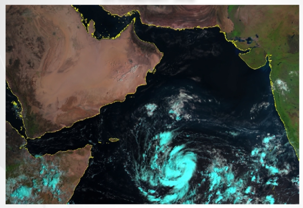


Muscat: Oman's meteorological authority issued a statement on Friday, alerting that a tropical depression has formed over the Arabian Sea, situated approximately 1,100 kilometers away from the coast of Oman. There are indications that this depression may develop into a Category 1 cyclone by Sunday.
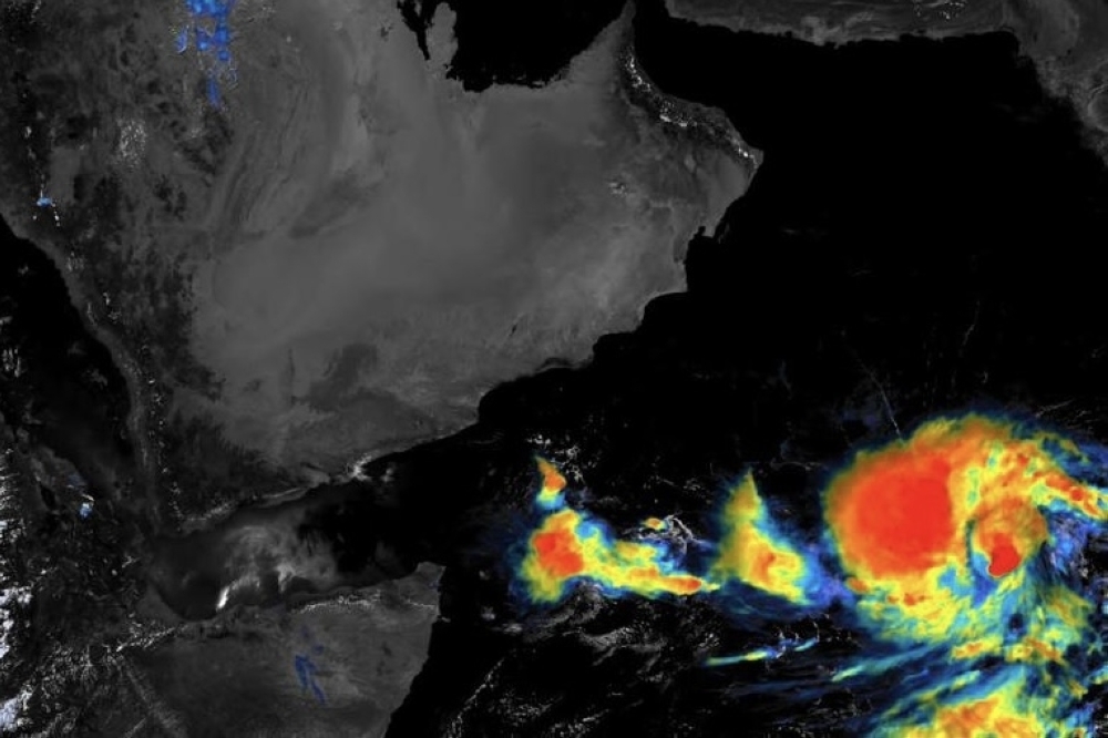
According to the statement released by the Met Office, their latest satellite imagery and analysis from the National Center for Early Warning of Multiple Hazards indicates the evolution of a low-pressure system in the Arabian Sea into a tropical depression. The depression's current location is around 9.3 degrees North latitude and 62.0 degrees East longitude.
Presently, this tropical depression is located roughly 1,100 kilometers away from Oman's coastline. The wind speed around its center ranges from 20 to 27 knots, with the nearest rainy cloud mass situated approximately 900 kilometers away in the Sadah region of Oman.
Forecasts suggest that this tropical depression will continue to move west-northwest towards the coasts of Dhofar Governorate in Oman and the Republic of Yemen. It is expected to intensify into a deep tropical depression within the next 24 hours and could potentially evolve into a tropical storm within the following 48 hours.
The direct impact of this weather system is predicted to commence on Dhofar and Al Wusta on Sunday, October 22. There is a possibility that the center of the system may pass between midnight on Monday and Tuesday morning, lying between Dhofar Governorate and Yemen's Al-Mahra Governorate.
Saturday, October 21, 2023:
The meteorological conditions have deepened into a tropical storm, with wind speeds around the center ranging from 34 to 63 knots. This is accompanied by the flow of high and medium-level clouds along the coasts of the Arabian Sea.
Warnings:
Wave heights along the coastal areas of South Al Sharqiya, Al Wusta, and Dhofar governorates, with maximum wave heights ranging from 2.5 to 4.5 meters.
Sunday, October 22, 2023:
The meteorological conditions have intensified, now classified as a Category 1 cyclone, with wind speeds around the center ranging from 64 to 75 knots (approximately 128 to 150 km/h). The center of the system is located approximately 200 to 300 kilometers away, with the direct impact beginning on Dhofar Governorate and parts of Al Wusta, accompanied by heavy rain and cloud cover.
Warnings:
Expect heavy rainfalls, ranging between 50 and 200 mm, which may cause flash floods in wadis.
Strong winds, with speeds of 25 to 35 knots (50-70 km/h), which may lead to the dispersal of materials and tree falls.
Wave heights along the coastal areas of the Arabian Sea, with maximum wave heights ranging from 4 to 7 meters, and a potential for storm surge.
Monday, October 23, 2023:
The meteorological condition has downgraded to a tropical storm, with wind speeds around the center ranging from 34 to 63 knots (approximately 68 to 125 km/h). The center of the system is located approximately 50 to 150 kilometers away, with the opportunity for the center of the condition to pass between midnight and Tuesday morning, between Dhofar Governorate and Yemen's Al-Mahra Governorate.
Warnings:
Heavy rainfalls are expected, ranging between 50 to 200 mm, which may cause flash floods in wadis.
Strong winds, with speeds of 25 to 35 knots (50-70 km/h), which may lead to the dispersal of loose materials and the falling of trees.
Wave heights along the coastal areas of the Arabian Sea, with maximum wave heights ranging from 4 to 7 meters, and the potential for a storm surge.
The Civil Aviation Authority advises everyone to closely follow the issued weather bulletins and reports for updates and safety information.
Oman Observer is now on the WhatsApp channel. Click here