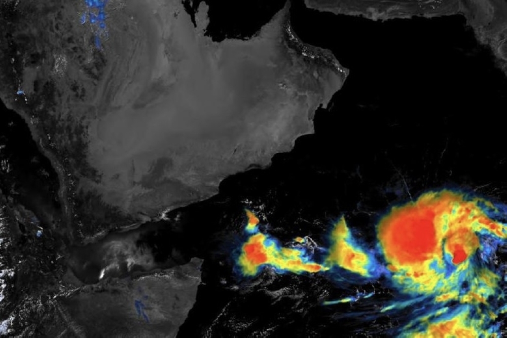

Muscat: The tropical depression is now classified as tropical storm located over the central Arabian Sea nearly 1,160 km from the coast of Sultanate of Oman. The tropical storm and will be called "Biparjoy".
The latest satellite image shows the development of the tropical depression to the level of a tropical storm, and it will be called (Biparjoy). The tropical storm is centered in the south-central Arabian Sea and is about 1,160 km away from the coast of the Sultanate of Oman, with chances of its movement towards the north towards the center of the Arabian Sea. It is likely to continue as a storm during the next three days, with chances of it later developing into a first-class cyclone, and chances of high clouds flowing over the skies of the Sultanate of Oman during the next five days.
Earlier today, Oman Observer staff has spoken to Bushra al Sadi, Meteorology Specialist at National Multi Hazard Warning Centre, said “The tropical system is expected to move north west of the Arabian Sea with no direct impact over Oman in the next five days. Maybe after five days the direction might change. There could be direct or indirect affects over the coast of Oman until then everything is stable in terms of weather conditions,”
Earlier in the week one of the weather forecasters had explained that one of the signs that there is a status change the tropical system would be seen in the wind.
Every category is different from the low pressure to depression, deep depression to tropical storm and tropical cyclones. The wind speed around the center of the tropical storm is 13 knots according to Al Sadi.
“For now the movement shows toward north to northwest most likely to the Indian coast and Pakistani coast, but maybe in the coming hours and days that could be changes,” noted al Sadi.
She explained that there is a low chance of Oman’s coast getting affected. “But we will know only in five days time,” she said.
The wind however will not cool down the temperature as summer is approaching, but can cause downdraft wind resulting in dust rising and movement of unstable objects.
Along the Oman Sea coast, winds will be northeasterly light to moderate during the day time becoming southwesterly light at night, while along the rest of the governorates it will be southerly to southwesterly light to moderate occasionally fresh along the coastal areas of the Arabian Sea and deserts areas.
Oman Observer is now on the WhatsApp channel. Click here


