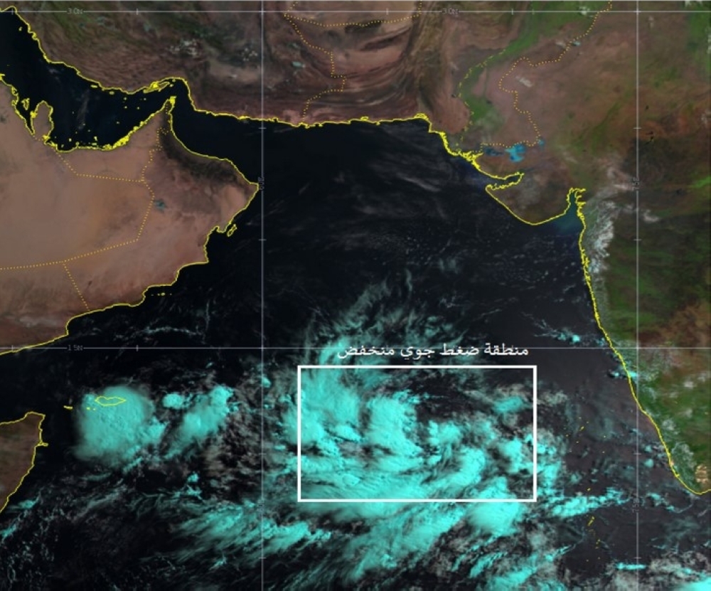


The National Centre for Early Warning of Multiple Hazards has on Wednesday released the latest weather forecasts, indicating the formation of a low-pressure system in the Southeast of the Arabian Sea. This system is expected to intensify into a tropical depression over the next 48 hours.
The National Multi Hazard Early Warning Center's analysis pinpointed the center of the Low Pressure Area at approximately 10.5°N latitude and 68.3°E longitude, located 1440 kilometers from Oman's nearest coast, as stated by the weather agency. Current wind speeds around the system's center are estimated to be less than 17 knots. However, the system is likely to progress into a tropical depression within the next 48 hours, although it is not expected to directly impact Oman's weather for the next four days.
Initial forecasts suggest that the tropical system will move towards the coasts of Oman and Yemen, leading to the advection of clouds and heavy rain from Sunday afternoon onwards, primarily affecting the Al Wusta and Dhofar governorates.
Simultaneously, the Met Office issued a statement on Wednesday, warning of potential thunderstorms with precipitation ranging from 15 to 40 millimeters and downdraft winds. These weather conditions are expected to be most pronounced across mountainous regions in South al Batinah, North al Batinah, Dakhiliyah, Muscat, Ad Dahirah, and al Shariqiyah governorates..
Meanwhile, the Met Office on Wednesday said due to cumulous clouds formation, there are chances of thunder rains ranging from 15-40 mm with downdraft wind mostly across mountain areas of South al Batinah, North al Batinah, Dakhiliyah, Muscat, Ad Dahirah and al Shariqiyah governorates.
Oman Observer is now on the WhatsApp channel. Click here