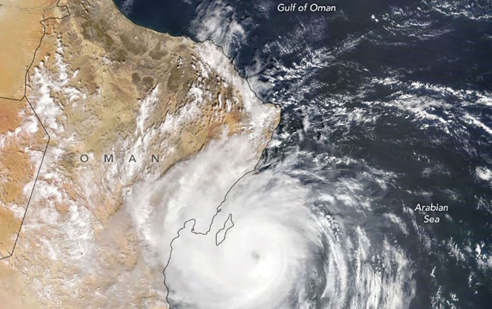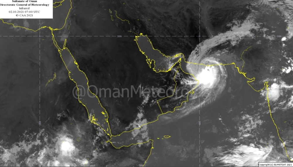


Muscat: Tropical cyclone, Shaheen, continuing to move towards the coastal areas of Oman Sea, is moving westward and by Sunday is expected to head toward North Al Batinah. Presently the estimated surface wind speed around the centre between 65 to 82 knots (118 to 141 km/hr). The potential days for the impact of the cyclone are considered to be from Saturday to Monday and by Tuesday, according to the meteorologist from Oman Met Office.
“It could be places like Suwaiq, shinas, or Liwa where it could make a landfall. The seas will be high and already South Sharqiya coast has begun to experience high swells of more than seven meters and some penetration of storm surge into the land has already been noted. These are the first signs of the cyclone. Sunday is the biggest day with heavy rains expected from Muscat to North Al Batinah Al Dhahira, Al Buraimi and Al Dakhiliya and may extend to the governorates of Musandam, North Al Sharqiya and South Al Sharqiya,” said Dr Said al Sarmi, meteorologist at the National Multi Hazards Early Warning Center.
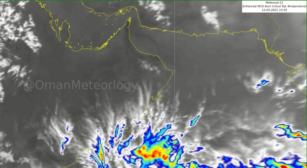
While the tropical cyclone moves, there is a huge band of convective clouds which is expected to move west and hit South Al Sharqiya, Muscat, North Al Batinah and South Al Batinah gradually, which will bring in moderate to heavy rainfall.

“We have got reports from Ras Al Hadd, Qalhat and Sur that they are already experiencing high waves. All the coasts from Ras Al Hadd to Musandam are expected to experience high swells and high waves as the cyclone approaches North Al Batinah. We expect heavy rainfalls which can cause flash floods so people must avoid wadis and the low lying areas,” he pointed out.
One of the other concerns is the strong wind that is expected. The centre of the cyclone has reached 65 knots which is the classification of category one.
“As it approaches Oman, most of the strong winds are in the sea that is why we are experiencing high waves but when it reaches North Al Batinah, the coastal areas might experience wind of 45 to 55 knots which is around 90 to 100 km/hr. And this is strong wind and we can expect it from Sunday along the areas from Muscat to Al Dhahirah and Al Buraimi.
He said the community must stay aware of the latest developments in the three days regarding the potential severe flash floods due resulting from heavy rainfall.
Muttrah Souq is one of the places that often get impacted with the storm surge and precautions have to be taken. “All low lying places and residential areas throughout the mentioned coasts have to be cautious,” he stressed.
Latest satellite images and weather charts analysis at the National Multi Hazards Early Warning Center indicates that cyclone is now category one and is expected to directly impact the coastal areas from Muscat to North Al Batinah governorates starting from Sunday morning with strong winds and heavy rains expected to be ranging between 200 and 600 millimeters.
Sea condition is expected gradually to be extremely rough over the coastal areas between South Al Sharqiyah to Musandam Governorates with maximum height ranging between 8 and 12 meters.
Oman Observer is now on the WhatsApp channel. Click here