




MUSCAT: The Financial Services Authority (FSA) has underscored the growing role of advanced technologies in transforming risk management practices, highlighting artificial intelligence, data analytics, satellite imagery and drone technologies as key enablers for enhancing the insurance sector’s preparedness against natural disasters and climate-related risks.
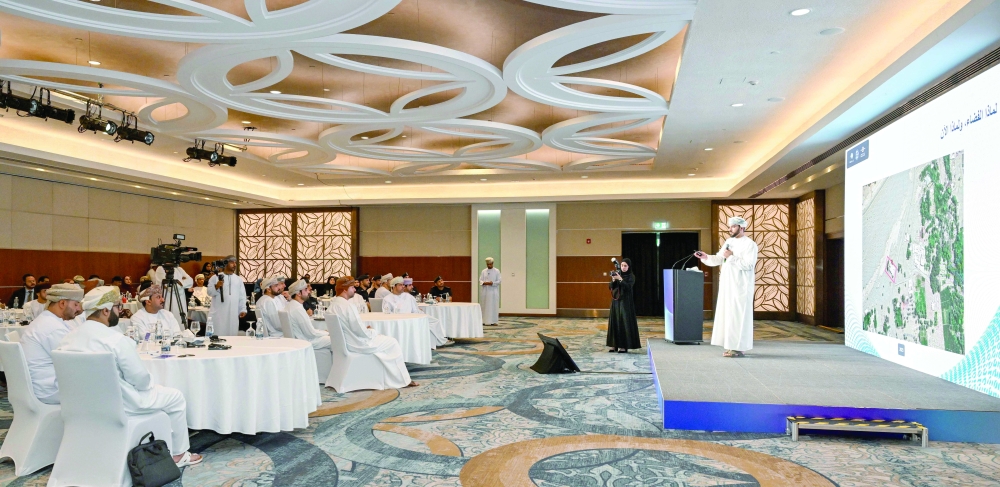
The remarks were made during a specialised workshop titled “Flood Risk Analysis Using Satellite and Drone Technologies,” organised by the FSA in collaboration with Adasah Oman and Esbar on Tuesday.
The event brought together representatives from the Civil Defence and Ambulance Authority (CDAA), insurance companies and brokers, as well as experts in geospatial technologies, remote sensing and risk management.
Ahmed bin Ali al Maamari, Deputy Executive President of the Financial Services Authority, said technological advancements in artificial intelligence, remote sensing and data analytics have fundamentally reshaped the way risks are assessed and managed.
He noted that the insurance industry is increasingly relying on accurate data and predictive analytics to support more informed underwriting decisions, improve insurance products and enhance the quality of services delivered to policyholders.
Al Maamari stressed that accelerating climate change requires a shift from responding to disasters after they occur towards proactive risk prediction, preparedness and mitigation.
“Adopting modern technologies has become a strategic choice to strengthen institutional readiness and improve the overall efficiency of the risk management ecosystem,” he said.
He added that the severe weather events experienced by the Sultanate of Oman in recent years have highlighted the need for more sophisticated tools to assess natural hazards, supported by advanced technologies capable of collecting and analysing high-quality data.
According to Al Maamari, these technologies contribute to faster emergency response, more accurate damage assessments and evidence-based decision-making, ultimately enhancing the insurance sector’s ability to manage natural catastrophe risks more effectively.
The workshop aimed to showcase the latest technological solutions for flood risk analysis while strengthening the insurance sector’s capability to utilise satellite imagery and unmanned aerial systems for data collection, damage assessment, underwriting and claims settlement processes.
Eng Younis al Siyabi highlighted the importance of integrating Fourth Industrial Revolution technologies into residential area assessments and geospatial planning.
He said such technologies significantly enhance predictive capabilities for natural disaster risks, enabling authorities to minimise the impact of extreme weather events on residential communities and private property while safeguarding lives during heavy rainfall and tropical weather systems.
Al Siyabi emphasised that effective utilisation of available geospatial data supports strategic planning and evidence-based decision-making, enhancing the preparedness of relevant authorities and improving their capacity to respond to potential risks before they escalate.
Azzan bin Abdullah al Maamari, Commercial Sector General Manager at Adasah Oman, said the workshop presented practical applications of satellite imagery and drone technologies in flood risk analysis and demonstrated how these tools can support the insurance industry with highly accurate data.
He explained that such technologies help improve asset valuation, enhance underwriting efficiency and accelerate post-disaster damage assessments, in line with Oman’s digital transformation agenda and future development aspirations.
The workshop concluded with a renewed emphasis on expanding the adoption of innovative technologies within the insurance industry while strengthening collaboration between regulators, technology providers and insurance companies to build a more resilient and efficient natural disaster risk management framework.
Oman Observer is now on the WhatsApp channel. Click here