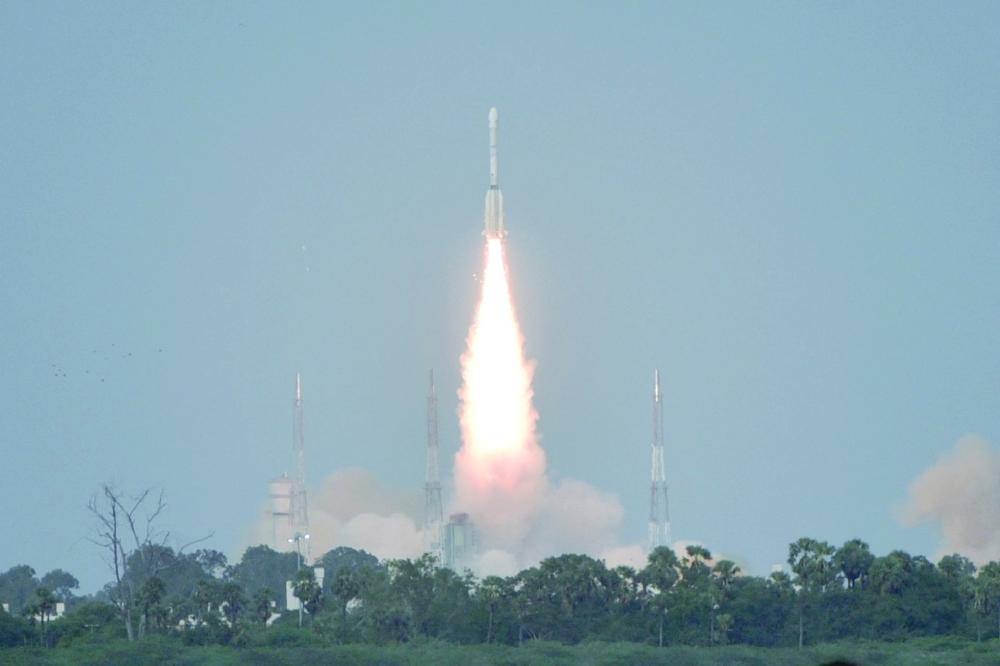





WASHINGTON: A formidable new radar satellite jointly developed by the United States and India launched on Wednesday, designed to track subtle changes in Earth’s land and ice surfaces and help predict both natural and human-caused hazards. Dubbed NISAR (NASA-ISRO Synthetic Aperture Radar), the pickup truck-sized spacecraft blasted off around 5:40 pm from the Satish Dhawan Space Centre on India’s southeastern coast, riding an ISRO Geosynchronous Satellite Launch Vehicle rocket.
Livestream of the event showed excited schoolchildren brought to watch the launch and mission teams erupting in cheers and hugging. Highly anticipated by scientists, the mission has also been hailed as a milestone in growing US-India cooperation between President Donald Trump and Prime Minister Narendra Modi. “Our planet surface undergoes constant and meaningful change,” Karen St Germain, director of NASA’s Earth Science division, told reporters ahead of launch. “Some change happens slowly. Some happens abruptly. Some changes are large, while some are subtle.”
By picking up on tiny changes in the vertical movement of the Earth’s surface — as little as one centimeter — scientists will be able to detect the precursors for natural and human caused disasters, from earthquakes, landsides and volcanoes to aging infrastructure like dams and bridges. “We’ll see land substance and swelling, movement, deformation and melting of mountain glaciers and ice sheets covering both Greenland and Antarctica, and of course, we’ll see wildfires,” added St Germain, calling NISAR “the most sophisticated radar we’ve ever built.”
India in particular is interested in studying its coastal and nearby ocean areas by tracking yearly changes in the shape of the sea floor near river deltas and how shorelines are growing or shrinking. Data will also be used to help guide agricultural policy by mapping crop growth, tracking plant health, and monitoring soil moisture. Equipped with a 12-meter dish that will unfold in space, NISAR will record nearly all of Earth’s land and ice twice every 12 days from an altitude of 747 kilometers.
As it orbits, the satellite will continuously transmit microwaves and receive echoes from the surface. Because the spacecraft is moving, the returning signals are distorted, but computer processing will reassemble them to produce detailed, high-resolution images.
Achieving similar results with traditional radar would require an impractically large 12-mile-wide dish. NISAR will operate on two radar frequencies: L-band and S-band. The L-band is ideal for sensing taller vegetation like trees, while the S-band enables more accurate readings of shorter plants such as bushes and shrubs. — AFP
Oman Observer is now on the WhatsApp channel. Click here