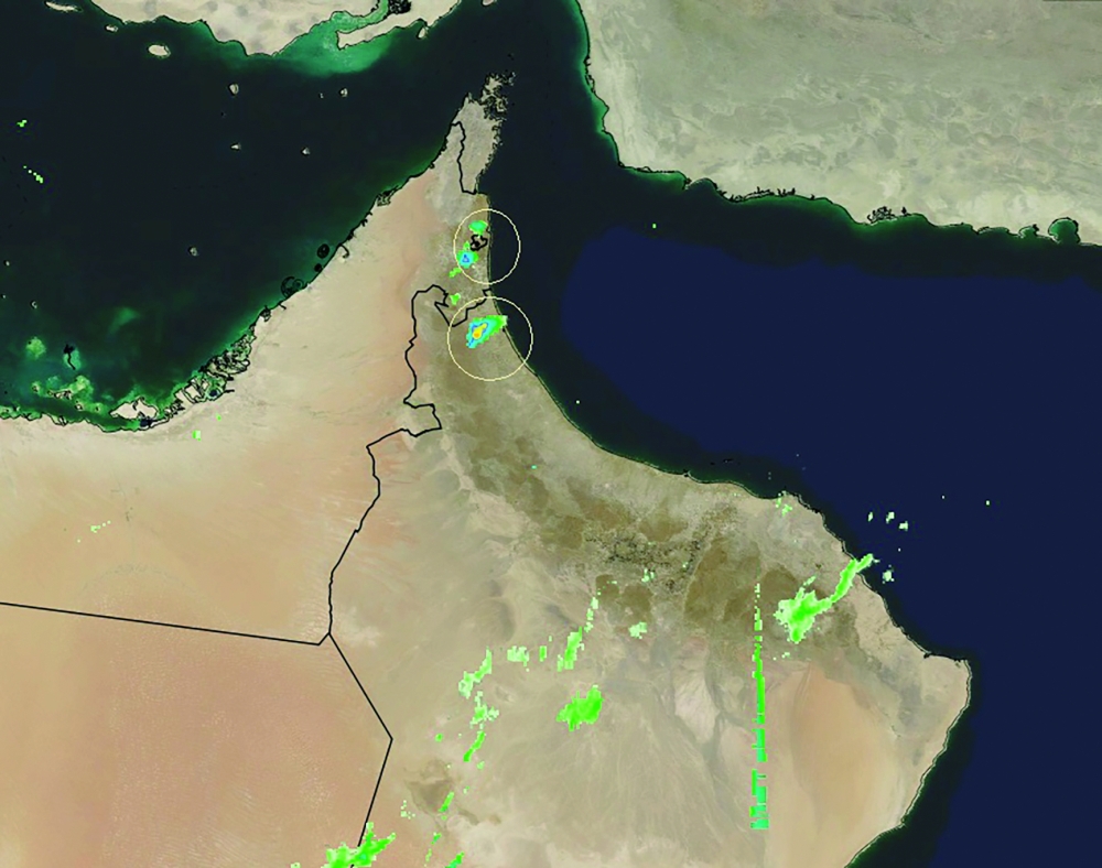


A trough of low pressure began on Wednesday evening with rainfall over the governorates of Al Batinah North and Al Dhahirah. The official sources at Oman Meteorology, while speaking to the Observer said within six hours rains will begin over Al Hajar Mountains and by midnight rains are expected in Al Batinah South as well as areas around Al Hajar Mountains.
Analysis made by the National Multi-Hazard Early Warning Centre at the Civil Aviation Authority shows that the peak of the forthcoming adverse weather condition will begin on Thursday.
The precipitation is likely to pervade the governorates of Al Buraimi, Al Dhahirah, Al Batinah South, Al Dakhiliyah, Muscat and Al Sharqiyah North, with rainfall ranging between 20 mm and 80 mm.
Nasser bin Said al Ismaili, Director of the Department of Forecasts and Early Warning System at the Civil Aviation Authority, said that the rest of Oman’s northern governorates will also be moderately impacted by the weather condition.
“By Thursday most of the northern governorates will experience rainfall. There is above 30 per cent chance for clouds from Al Hajar Mountains to reach Muscat Governorate. This weather condition could last for 4-5 days, but could vary from governorate to governorate. It is important to note that this time Dhofar Governorate is included,” said a meteorologist at Oman Met Office.
He said that Al Hajar Mountains could enhance the clouds during midday when the temperature is maximum, impacting the westerly disturbance which has been titled 'Al Ikran' — derived from the term ‘Generosity’.
ONLINE CLASSES
All the governorates except Al Wusta will adopt online classes due to expected heavy thunderstorms accompanied by active downward winds along with hailstones on Thursday in the governorates of Buraimi, Al Batinah North, Al Batinah South, Muscat, Al Dakhiliyah, Al Dhahirah, Al Sharqiyah North and Dhofar. Isolated thundershowers are expected over governorates of Musandam, Al Sharqiyah South and Al Wusta.
EXERCISE CAUTION
The Civil Aviation Authority has called on everyone to exercise caution during rain and thunderstorms, and has requested everyone not to cross wadis, avoid low-lying areas, and do not venture into the sea during the period.
Active downward winds with speed ranging between 15-40 knots (28-90 km/hr) are expected during the period.
The sea wave height along the coast of Musandam Governorate and the Sea of Oman ranges between 2-3 metres.
Oman Met Office has warned of reduced visibility during thunderstorms.
Meanwhile, the National Committee for Emergency Management (NCEM) decided to activate national centres, subcommittees and other sectors tasked with addressing adverse weather conditions that are expected to prevail in the governorates of Muscat, Dhofar, Al Dakhiliyah, Al Sharqiyah North, Al Batinah South and Al Dhahirah with effect from 5 pm on Wednesday.
The authorities concerned will step up proactive action to limit the impacts of the weather condition and to deal with reports of potential damage.
In this regard, the National Committee for Emergency Management has called on everyone to take utmost caution to preserve the safety of lives and property, and to ensure to take information from the official authorities, and to follow the instructions issued by them.
Oman Observer is now on the WhatsApp channel. Click here