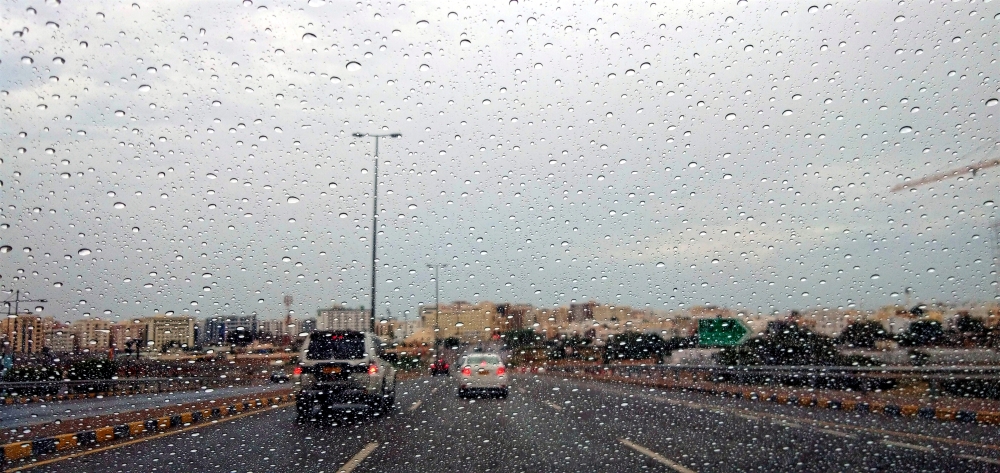


Influence of upper trough is expected to bring in rains to some of the governorates in the Sultanate of Oman this weekend.
The latest analysis numerical weather charts and satellite images from National Multi Hazards Early Warning Centre, Civil Aviation Authority, show the Sultanate of Oman is expected to be affected by upper trough of low pressure area associated with clouds advection over Governorates of Musandam, North Al Batinah and Al Buraimi starting from Friday evening as well as forthcoming days.
The weather forecast stated that there could be occasionally thundershowers, fresh winds, flash floods and flow of wadis with chances of clouds advection and isolated rain over governorates of North Al Batinah, Buraimi and coastal areas of Oman Sea.
The expected rainfall is forecast between 20 and 50mm and the weather is expected to be cloudy over the governorates of Musandam and North Al Batinah.
There is sea alert for the next two days - moderate to rough waves on the coasts of the Sea of Oman and the coasts of Musandam Governorate, with a maximum wave height ranging from 2.0-3.0 meters, and calm to medium waves on the coasts of the Arabian Sea (1.5 meters).
Mainly clear skies are expected over most of the Sultanate of Oman with chance of clouds advection over northern parts of the Governorates and chances of late night to early morning low level clouds or fog patches over parts of Al Dahirah, South Al Sharqiyah, North Al Sharqiyah, Al Wusta and Dhofar governorates.
Visibility may reduce during fog formation, warned Oman Met Office.
Over most of the sultanate winds will be northeasterly to easterly light to moderate and variable light at night along the coastal areas of Oman Sea.
Oman Observer is now on the WhatsApp channel. Click here