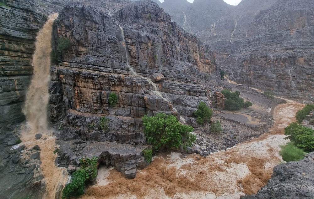


Muscat: Rainfall of varying intensity were reported in parts of Musandam and North Al Batinah governorates with the emergence of thunderstorms along with the intensification of clouds along the coasts of the Oman Sea as well as cloud formation on Al Hajar mountains on Tuesday.
“Possibility of rain continues in the coastal areas of Musandam, North Al Batinah, South Al Batinah, Muscat, South Al Sharqiyah and over Al Hajar mountains. By evening Muscat may also get rains. The chances for rain continues until Wednesday as per the weather forecast’’, said Mohammed al Amri, weather forecaster at Oman Met Office, Civil Aviation Authority.
Chances of thunderstorms accompanied by active downward winds are expected and there are chances of hail in the governorates of Musandam, North and South Al Batinah, Muscat and parts of the Al Hajar mountains (Al Dakhiliyah, South Al Batinah and Al Buraimi) and on the coastal areas of South Al Sharqiah during the afternoon and evening.
The statement from Oman Met Office also urged public to pay attention during thunderstorms associated with clouds, which may lead to the flying of unstable objects due to active winds. The weather experts also warned of flash floods as wadis became active due to the low pressure trough as was already experienced in Musandam.
“The highest rainfall was recorded in Dibba with 12 mm and Shinas registered 11 mm. The peak of rain will be experienced from Tuesday night to Wednesday,” explained Al Amri.
Continuing intensification of convective clouds is expected on the coasts of the Sea of Oman (the coasts of the governorates of Musandam, North and South Al Batinah and Muscat) with chances of rain later.
Oman Observer is now on the WhatsApp channel. Click here