

Muscat - The trough of low pressure over the Sultanate of Oman began its peak on Monday night and is expected to continue till Tuesday morning.
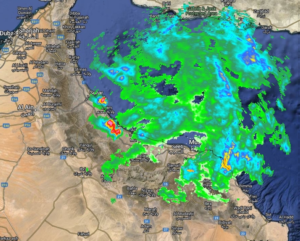
The convective clouds continued to flow over the coastal areas of the Sea of Oman and brought scattered rain on Monday bringing rain to wilayats Suhar, Saham, and Khabourah.
Expected rainfall is to range between 15 - 25 mm varying in different governorates.
The clouds are expected to continue to flow over most of the northern governorates of the Sultanate of Oman, with chances of cumulus clouds forming and rain of varying intensity, sometimes thundery, over the Hajar Mountains and parts of the governorates of Al Dakhiliyah, Al Dhahirah, North and South Al Sharqiyah, and Muscat. Al Buraimi, North Al Batinah, and South Al Batinah.
Speed of active downward winds is expected to range between 15-30 knots leading once again to a reduction in horizontal visibility and the displacement of unstable materials. Rough waves are to continue across the coasts of the Arabian Sea topping it to 4 m high and 1.5 m to 2 m across Oman Sea.
Cumulus cloud activity over the mountainous areas of Al-Buraimi and Al-Dhahirah governorates, with rainfall of varying intensity, active downward winds, and hailstones, was observed and rain cells are expected to continue during the forthcoming hours.
The impact of the low pressure was experienced in the evening hours of Monday over the Hajar Mountains, the governorates of Al Dakhiliyah and Al Dhahirah, and parts of North and South Al Sharqiyah, Muscat, Al Buraimi, North Al Batinah, and South Al Batinah.
Downward winds were active with a speed of 15-45 knots and this could lead to reduced horizontal visibility and the movement of unstable materials, warned the Oman Met Office.
On Wednesday, August 7, there are chances of cumulonimbus clouds to continue to form over the Hajar Mountains and neighboring areas and parts of the South Al Sharqiyah and Al Wusta governorates Active downward winds and high sea waves are expected to continue.
Oman Observer is now on the WhatsApp channel. Click here