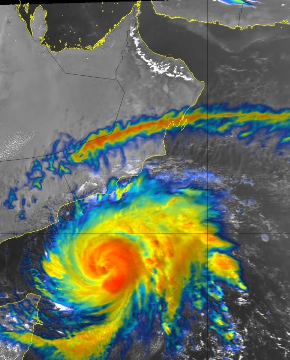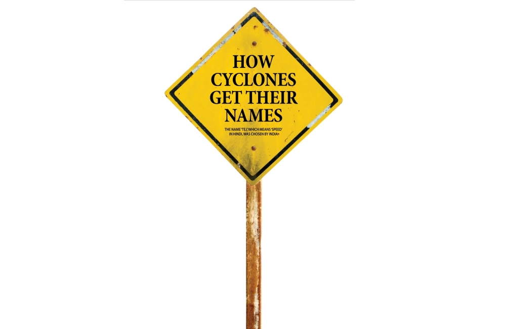


Muscat: Cyclone Tej is currently on a path to make landfall in Yemen on Tuesday. The name ‘Tej,’ which means ‘speed’ in Hindi, was chosen by India and is a part of the list of storm names adopted by a 13-member panel representing countries in the region in April 2020.
The process of naming cyclones involves careful consideration to ensure that the names remain neutral, avoiding any political or religious connotations. They must not hurt the sentiments of any community and should be short, easy to pronounce, and have eight letters or fewer.
The 13 member countries, including Bangladesh, India, Iran, Maldives, Myanmar, Oman, Pakistan, Sri Lanka, Thailand, and others, select the names for cyclones every few years, and they are used in chronological order.
After Cyclone Tej, it is Iran and Maldives that will have the honor of naming the following storms. Iran’s chosen name is ‘Hamoon,’ and Maldives has named the next cyclone ‘Midhili.’ The last cyclone on the list was Cyclone Biparjoy, named by Bangladesh, which made landfall in India’s Gujarat as an extremely severe cyclonic storm in mid-June.
The practice of naming storms began arbitrarily, but in the mid-1900s, it was decided to use feminine names for storms. Later, the World Meteorological Organization (WMO) introduced the alternating use of both men’s and women’s names. In cases where a cyclone proves exceptionally devastating or costly, the WMO may decide to retire its name out of sensitivity, and a new name takes its place. The naming of cyclones in the Bay of Bengal and the Arabian Sea was officially agreed upon during the 27th Session of the WMO/ESCAP Panel on Tropical Cyclones in 2000, held in Muscat, Oman.
As per forecast from Oman Met Office, Tej will continue to move west-northwest towards the coasts of Dhofar governorate and the Republic of Yemen (Al Mahra) and is likely to further intensify into a Category 4 cyclone within the upcoming 24 hours around 4 pm on Sunday. It will be downgraded to Category 3 around 4 am on Monday, further weakening to Category 2 before making landfall as Category 1 probably in Yemen on Tuesday.
More powerful cyclones
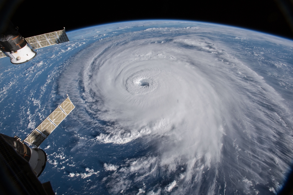
“The overall number of tropical cyclones per year has not changed globally but climate change has increased the occurrence of the most intense and destructive storms,” according to the World Weather Attribution (WWA), a group of climate scientists and climate impact specialists whose goal is to demonstrate reliable links between global heating and certain weather phenomena. The most violent cyclones — categories three to five on the Saffir-Simpson scale — that cause the most destruction have become more frequent, the WWA said.
Climate change caused by human activity influences tropical cyclones by warming the air and oceans and by triggering a rise in sea levels.
“Tropical cyclones are the most extreme rainfall events on the planet,” the WWA said in its publication “Reporting Extreme Weather and Climate Change”.
Since the atmosphere is warmer, it can hold more water, so when it rains it pours.
“A rise in air temperature of three degrees Celsius can potentially produce a 20-per cent increase in the quantity of rain generated by a cyclonic event,” said Cloppet.
It is these intense torrential downpours that lead to sometimes fatal floods and mudslides, as was the case of Cyclone Freddy, which killed hundreds of people in Malawi and Mozambique earlier this year.
Climate change is also warming the oceans. This warm water fuels cyclones and gives them their strength.
“Climate change therefore creates the conditions in which more powerful storms can form, intensify rapidly and persist to reach land, while carrying more water,” the WWA said.
Shifting north
The fierce winds produced by cyclones generate storm surges which can cause coastal flooding.
These storm waves are higher now than in previous decades because of the sea level rise triggered by climate change.
Scientists also expect to see cyclones in places they have not happened before because global heating is expanding the regions where tropical sea water conditions occur.
“It’s as if the tropics were spreading,” Cloppet said.
“Areas that aren’t really affected now could be hit much harder in future.”
The WWA agreed: “As ocean waters warm, it is reasonable to speculate that (tropical) storms will shift further away from the Equator.” “A northward shift in cyclones in the western North Pacific, striking East and Southeast Asia, (is) a direct consequence of climate change,” it said.
As a result, they could strike in relatively unprepared locations that have not, in the past, had reason to expect them.
Oman Observer is now on the WhatsApp channel. Click here