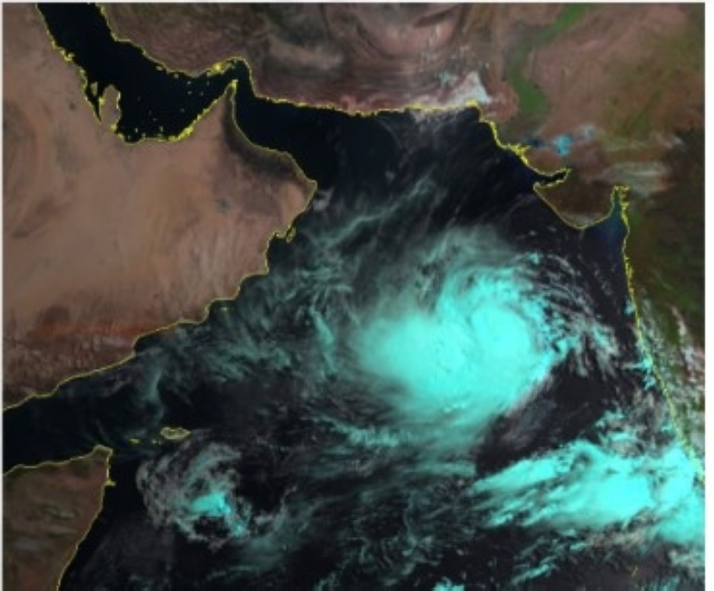
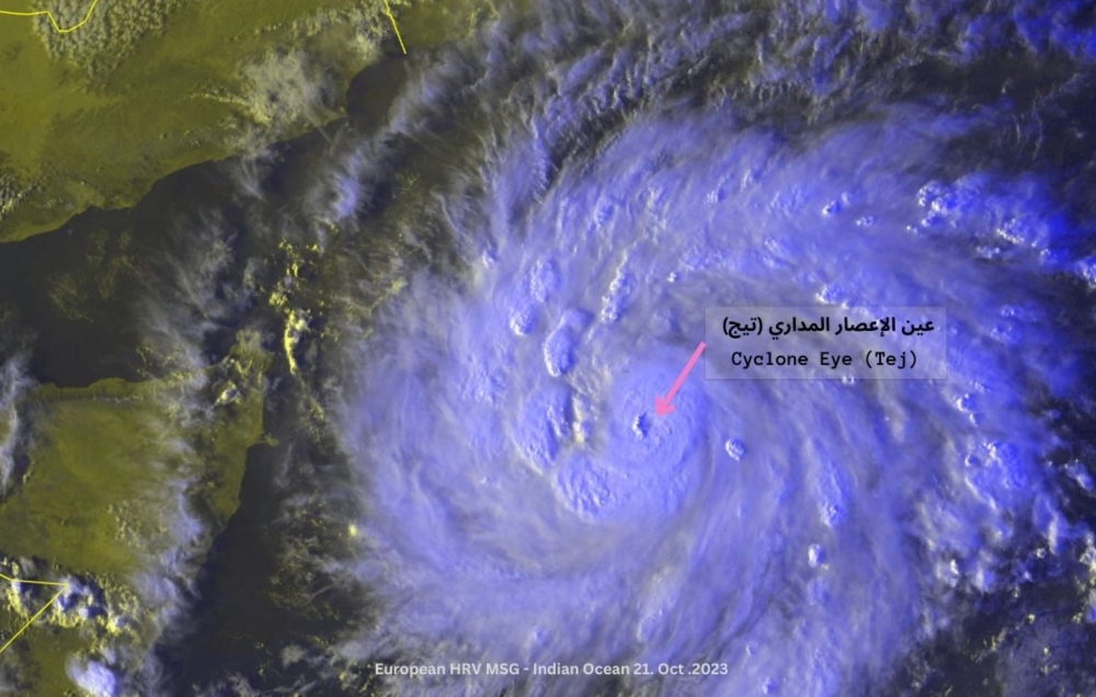
Muscat: The latest satellite images and analyses from the National Center for Early Warning of Multiple Hazards indicate the system is now Category 1 Cyclone, located southwest of the Arabian Sea.
The cyclone Tej is now located at 11.02 degrees North latitude and 57.29 degrees East longitude. It is about 690 kilometers away from the coasts of Oman.
The wind speed around the center ranges from 64 to 82 knots, and the nearest rainy cloud mass is located about 400 kilometers away in the Willayat of Sadah.
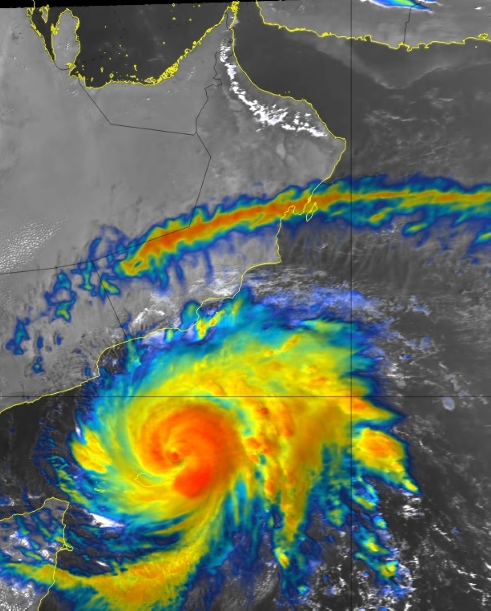
The prediction of the cyclone tropical will move west-northwestward toward the coasts of Dhofar Governorate and Yemen's Al-Mahra Governorate.
The direct impact is expected to begin on Dhofar and Al Wusta on Sunday evening.
The landfall of the Cyclone is expected to be on Tuesday morning between Dhofar Governorate and Yemen's Al-Mahra Governorate but it will intensify into Cyclone 2 in the next 36 hours.
The direct impact is expected by the advection of rainy clouds over the AL Wusta and Dhofar governorates.
Heavy rainfalls expected may range between 50 — 200 mm and cause flash floods (Wadis). Strong winds with speeds of 25 to 35 kt (46-64 km/h) may lead to the dispersal of loose materials and the falling of trees.
Wave height along the coastal areas of Arabian Sea with maximum wave high ranging from 4 to 7 m with inundated water due to storm surge.
Monday:
The system continues as a category 1 cyclone and is expected to intensify as a category 2 cyclone with wind speed around the center ranging from 64 to 88 knots (approximately 124 to 159 km/h).
The center of the system is located approximately 50 to 150 kilometers away, with direct impact towards Dhofar and parts of AL Wusta Governorates and advection of clouds associated with very heavy rainfall. Warnings: Heavy rainfalls expected may range between 200 — 600 mm and cause flash floods (Wadis).
Strong winds with speeds of 30 to 60 kt (55-111 km/h) may lead to the dispersal of loose materials and the falling of trees.
Wave height along the coastal areas of Arabian Sea with maximum wave high ranging from 4 to 7 m with inundated water due to storm surge.
Tuesday:
The gradual landfall will be as a category 1 tropical cyclone / tropical storm with wind speed around the center ranging from 50 to 75 knots (approximately 92 to 139 km/h) between the areas of Dhofar Governorates and Yemen's Al-Mahra Governorate with continued direct impact towards Dhofar and parts of Al Wusta Governorates with advection of clouds associated with very heavy rainfall.
Warnings:
Heavy rainfalls expected may range between 200 — 800 mm causing flash floods (Wadis). Strong winds with speeds of 50 to 75 kt (92-139 km/h) may lead to the dispersal of loose materials and the falling of trees. Wave height along the coastal areas of Arabian Sea with maximum wave high ranging from 4 to 7 m with induned water due to storm surge.
Oman Observer is now on the WhatsApp channel. Click here