

MUSCAT, JULY 2
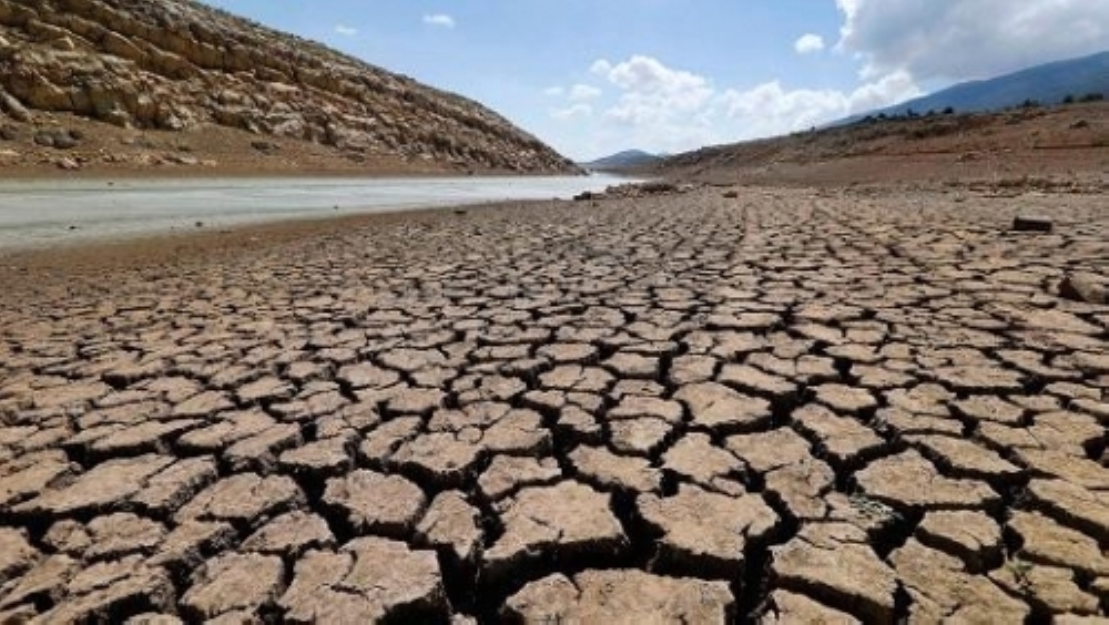
Seeking to bolster the country’s preparedness against flash floods – an increasingly worrying trend attributable to climate change – the Omani government is preparing to undertake a comprehensive review of flooding threats aimed at developing risk management and emergency response plans covering vast swathes of the Sultanate of Oman.
The initiative is being spearheaded by the Ministry of Agriculture, Fisheries and Water Resources whose broad remit also includes the construction of flood protection dams, recharge dams and reservoirs.
In a series of tenders floated in recent weeks, the Ministry has invited qualified consultants to bid for contracts seeking advisory services encompassing an array of objectives, including the updating and development of Flood Hazard Maps, as well as the preparation of Flood Risk Management and Emergency Response Plans. These studies cover all areas of Oman prone to flash flooding, notably Muscat, Dhofar, North and South Al Sharqiyah, Al Dakhiliyah, Al Dhahirah, Al Wusta, Musandam and Buraimi governorates.
Besides helping strengthen Oman’s defences against flood-related threats, the updated flood risk maps will also help identify areas that are susceptible to flooding and thus subject to more stringent design and construction safeguards.
“The purpose of flood plain, flood hazard and flood risk mapping is the geographical identification and illustration of areas at different levels of risk from flood hazard,” the Ministry noted in a brief overview. “In this respect, flood maps need to be designed to meet end-user needs. This is important in order to convey the complex messages about flooding and flood risk. Flood hazard maps show areas which could be flooded according to (low, medium, high) probabilities, complemented with type of flood, flood extent, water depths or water level as appropriate, flow velocity, or the relevant water flow direction.”
Selected consultants, according to the Ministry, will conduct their studies in three distinct phases: (i) Phase A will focus on rainfall and flow data analysis, (ii) Flood Mapping activities (covering the flood plain and preparation of flood hazard maps), and (ii) Formulation of Flood Risk Management and Emergency Plans.
Also as part of their remit, the consultants will be required to prepare rainfall intensity, duration and frequency tables for each governorate, alongside a Flood Design Manual. The goal is to improve the understanding of all stakeholders with regard to the rainfall-runoff co-relation in each major catchment area. Furthermore, using hydrological data, the consultants will have to identify risks associated with the main channels of wadis.
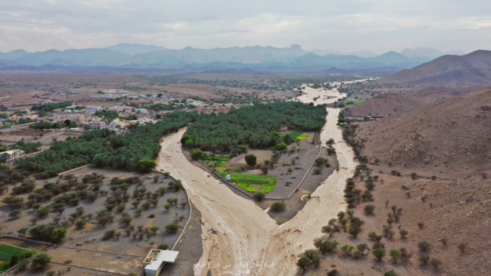
Following a succession of devastating flood events witnessed in recent years, Omani authorities have ramped up investment in flood control and mitigation infrastructure targeting areas predisposed to severe flooding. Flood protection schemes are currently under various stages of development and construction in, among other governorates, Muscat, South Al Sharqiyah and Dhofar.
In April, flood protection projects planned across Wadi Al Ansab (Muscat Governorate), Wadi Tahwa (South Al Sharqiyah) and Wadi Al Zuhaimi (North Al Batinah) were accorded the status of public utility projects, effectively prepping them for implementation.
Besides claiming human lives, recent flood events in Oman have been responsible for severe damage to public infrastructure, private businesses and homes, farmland, and other economic assets.
Oman Observer is now on the WhatsApp channel. Click here