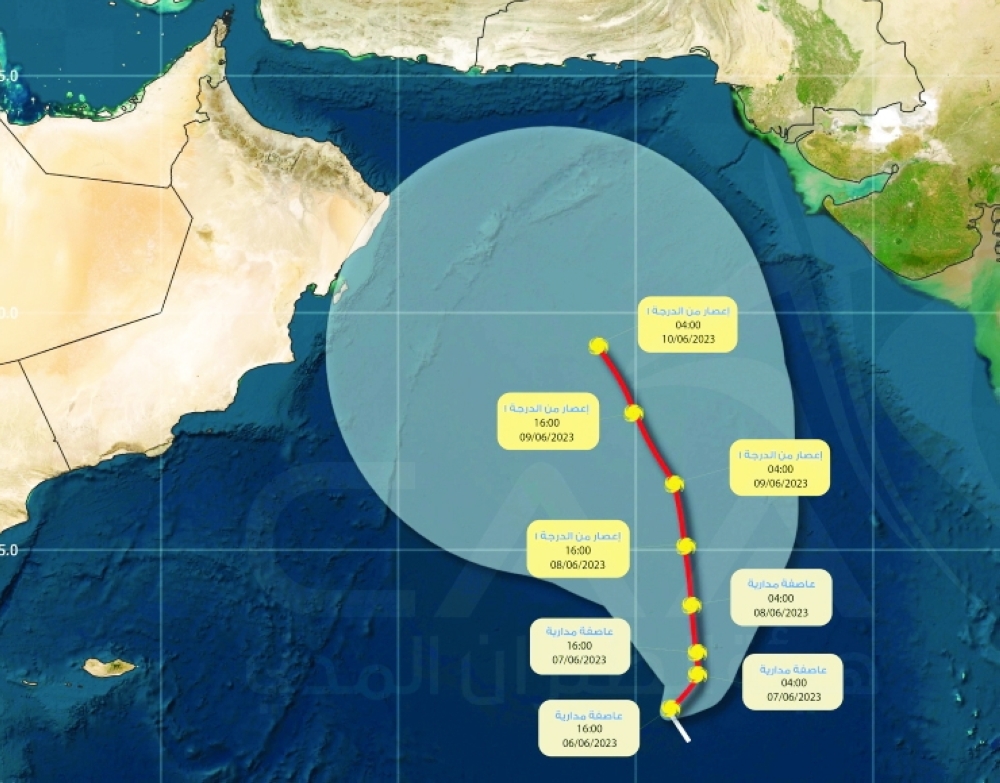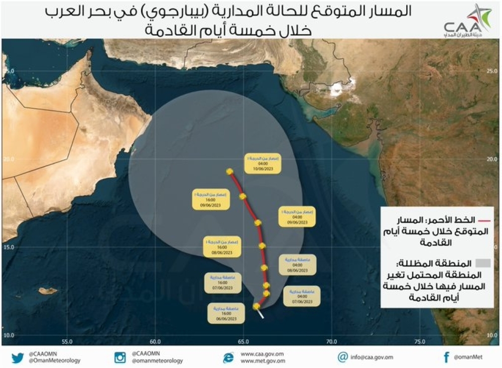


Tropical Cyclone Biparjoy, currently situated in the Arabian Sea, is gradually advancing towards the north-northwest with a speed of seven kilometres per hour.
Although Biparjoy's movement is relatively slower than average cyclones, meteorologists from the Oman Met Office are closely monitoring its path as it poses a potential threat to the coasts of India, Pakistan, Oman and Iran.
Fortunately, the likelihood of a direct impact on Oman is minimal. Presently, the cyclone's centre is positioned approximately 1,025 kilometres away from Oman's coast, with the nearest cloud formations located over 500 kilometres distant.
Experts are keeping a close eye on Biparjoy's intensification, with a possibility of it escalating to a Category 2 cyclone within the next 24 hours.
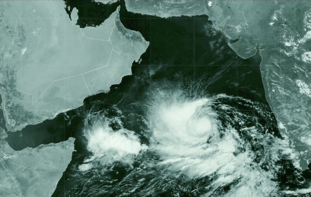
As a result, the region is experiencing an influx of high clouds along the Arabian Sea coast, a pattern expected to persist until Sunday. Additionally, cloud formations are anticipated over the picturesque Hajar Mountains during the afternoons.
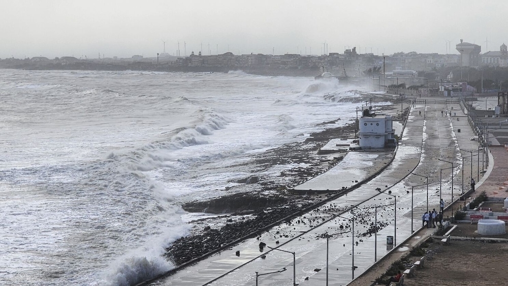
Fishermen are strongly advised to exercise caution and avoid venturing into the Arabian Sea, as rough seas with wave heights ranging between three to six metres are anticipated.
According to the latest weather maps and analysis from the National Multi-Hazard Early Warning Centre, Friday's forecast predicts the intensification of a tropical cyclone, reaching Category 3 status. The wind speed around the centre is estimated to range between 96 to 112 knots, posing potential risks and hazards.
In addition to the cyclone's strength, there is a high likelihood of high clouds advecting over the coastal areas of the Arabian Sea. This atmospheric phenomenon can result in significant changes to local weather conditions, potentially affecting visibility and bringing about other associated weather patterns.
The Oman Met Office remains vigilant and continues to provide regular weather updates to ensure the safety and well-being of the coastal communities in the region.
Meanwhile, agencies report that monsoon rain reached the coast of India's southernmost Kerala state on Thursday, offering relief to farmers after a delay of more than a week, marking its latest arrival in four years.
"Southwest Monsoon has set in over Kerala today, June 8, against the normal date of June 1," the state-run India Meteorological Department (IMD) said in a statement.
This year, the IMD had expected the rains to arrive over the state's coast on June 4 but the formation of severe cyclonic storm Biparjoy in the Arabian Sea delayed their onset.
The cyclone would gradually intensify further during next 18 hours, with winds gusting up to 170 km per hour, and would move approximately northwestwards during the next three days, the IMD said in a statement on Thursday.
Oman Observer is now on the WhatsApp channel. Click here