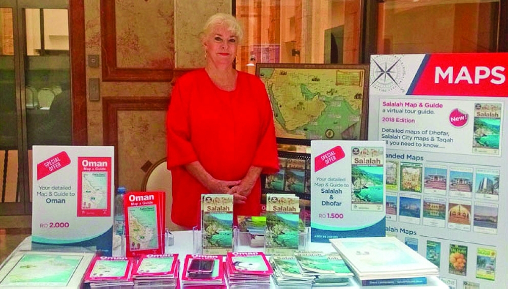
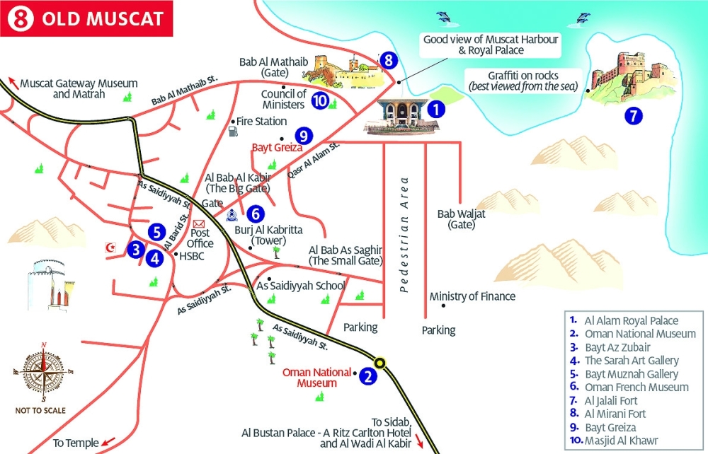
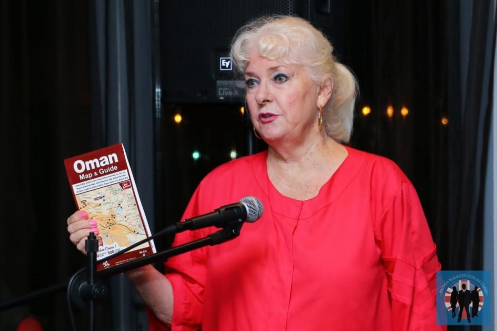


THE popular ‘Oman Map & Guide’ currently on sale in Oman is possibly the most detailed tourist map to date, comprising 20 maps compiled over many years.
This and other regional maps are thanks to a British lady, a long-time resident of Oman.
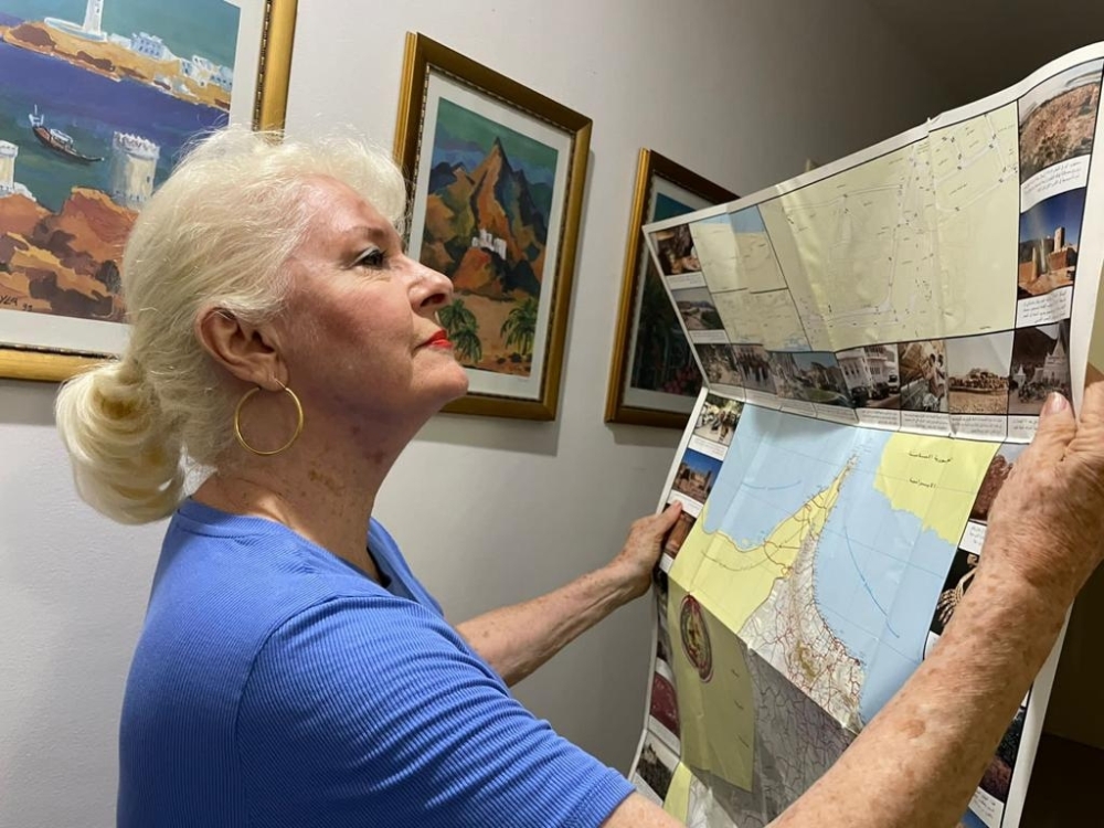
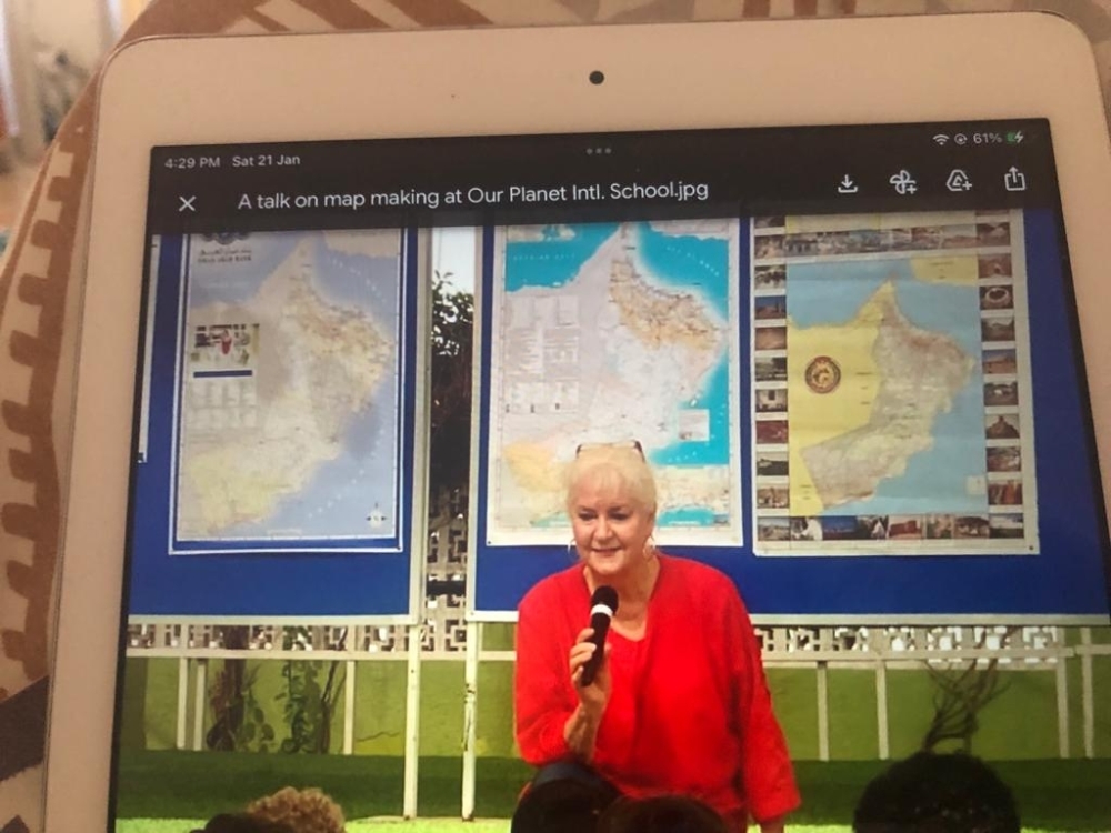
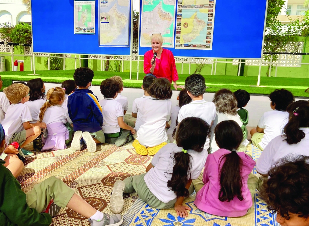
That’s Miriam Anne Malin, a cartographer and designer, who has worked laboriously over many years, travelling and mapping Oman.
Cartographers typically collect and verify data used in creating maps. This is what Anne has been doing for the past 37 years, having been resident in Oman since 1978.
She specialises in tourist maps though has done corporate and thematic maps for companies and various ministries.
As a cartographer, she has been pivotal in collecting, measuring and interpreting geographic information to create and update maps and charts in various Governorates of Oman.
From paper maps to the digital age, times have changed.
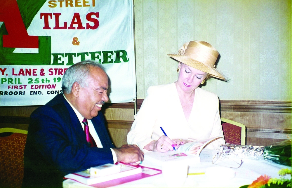
Anne recalls how, without a doubt, completing the Muscat Atlas & Gazetteer (A to Z) with 280 pages was by far the most challenging project, which really tested her strength.
It was her late husband, Bevis’s idea, to do the street guide, which was very well received. The couple employed six surveyors to map the whole of the Governorate. However, they had to lay them off halfway through when Bevis passed away in July 1996. Anne managed to finish the mapping and the book when completed which captured worldwide attention.
During the first 14 years of mapping, maps were done totally by hand. The map outline of Oman was obtained from the National Survey Authority, which was traced, and then created their own design.
Anne received excellent backing from the Municipality of Muscat, the National Survey Authority, the Ministry of Heritage and Tourism, the Ministry of Information and the Royal Oman Police (ROP), all of whom produced ‘No Objection’ letters in Arabic and English for the project.
Having been through the hardest grind, Anne recollects the huge difference between mapping in 1986 when she began, to what it is today.
Recalls Anne, “Our early maps were a massive body of work as they were in Arabic and English. We used the old ‘cut and paste’ method onto transparent sheets using light tables – a laborious task requiring endless patience. Errors had to be carefully scraped out using a scalpel.
“Thousands of way, street and area names were pasted. There were separate layers for seas and wadis, roads, text, images, symbols and mountains,’’ she says.
Only a fellow cartographer could appreciate the amount of work involved, as well as the patience required in those days using this method until the turn of the century.
The mapping looked considerably empty in their first editions, as there were far fewer roads back then. Today, all her projects are done on the computer and contain much more information, as there have been enormous strides in every field of development across Oman.
Later, from time to time, the then Ministry of Tourism (now the Ministry of Heritage & Tourism), requested she create tourist maps of new areas they wished to promote.
Anne did as much research as possible before travelling to the governorates and staying for however long it took.
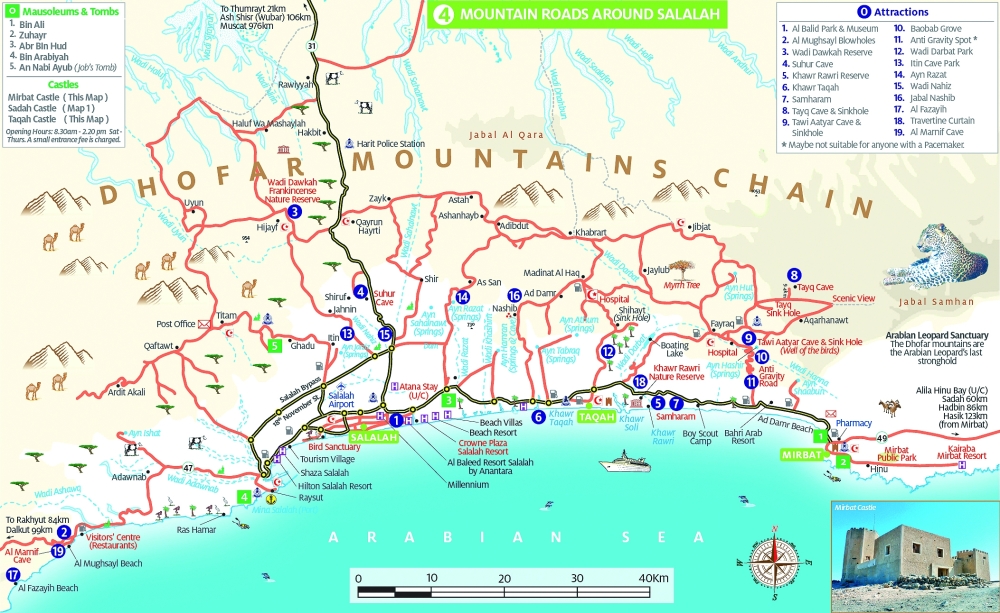
Whilst mapping Dhofar, she enjoyed driving along every road and track from Hasik to Dalkut.
They had an old map to work from but there was so much information to add to produce a very detailed map. Maps of Salalah and Dhofar have been updated many times over the years.
“Mapping Al Jabal Al Akhdar was an absolute joy,’’ Anne says, as she was invited to stay at the newly opened Sahab Hotel. The Supreme Committee for Mapping assisted in supplying elevations. “It was wonderful exploring every twist and turn on the mountain and every village,’’ she recollects.
She was a guest at the newly opened Alila Resort that had requested a branded map of the mountain. She later did six trekking maps around the resort.
About 15 years ago, the Ministry of Heritage & Tourism needed a map and guide of Musandam, a very interesting area, which entailed three trips.
She flew to Khasab and drove along all the streets, mountain roads and tracks as far as she could go and then took the coastal road to the UAE, stopping at each village on the way.
Anne returned to Muscat and later drove to Daba in the south of Musandam to stay there. She drove along Wadi Khab Ash Shamsi and the beautiful resort of Zaghy Bay as well as exploring villages in Wadi Bih. The third trip entailed mapping the tiny enclave of Madha where residents were delighted that she was putting their place on the map.
In the future, Anne looks forward to mapping the Al Dhahirah Governorate. As well as doing a couple of thematic maps, which require sponsorship. “My ideas eventually do come to fruition. I just have to be patient,’’ she confides.
@lijucherianoman
Oman Observer is now on the WhatsApp channel. Click here