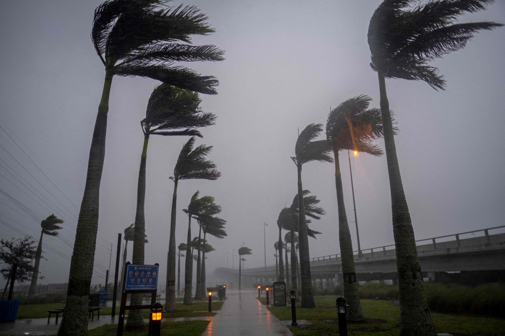


SARASOTA: After days of preparation, Hurricane Ian on Wednesday began lashing Florida's Gulf Coast with powerful winds and drenching rain, prompting authorities to warn residents to hunker down as the eye of the Category 4 storm lurked just offshore.
At 7 am Eastern, Ian was around 130 km southwest of Punta Gorda, Florida, carrying maximum sustained winds of 250 km per hour, the US National Hurricane Center said. It upgraded Ian an to an "extremely dangerous" Category 4 hurricane, though it said the storm was expected to weaken somewhat after reaching land.
"The storm is here," Florida Division of Emergency Management Director Kevin Guthrie said at a news conference. "Stay indoors. Stay away from windows." Florida Governor Ron DeSantis warned that people in four Gulf Coast counties were no longer safe to evacuate and urged residents to get off the roads and stay inside.
"It's time to hunker down and prepare for this storm. This is a powerful storm that should be treated like a tornado was approaching your home," he said. "This is going to be a nasty, nasty day or two days. This is going to be a rough stretch."
Earlier this week, authorities told more than 2.5 million residents to evacuate their homes for higher ground. But some, like Mark Feinman, a professional musician in St Petersburg, chose to stay put.
"There's absolutely no one on the roads here," Feinman, 36, said early on Wednesday. "The sky is this weird, ominous gray, and you can feel the wind gusts and the rain hits every little while. You can feel it in the air. My ears popped."
Feinman said he does not regret his decision to stay; he feels his house is secure, and fortunately for him, the storm jogged to the south of earlier forecasts, which showed it making a direct hit on the Tampa-St Petersburg area.
"We still expect it to get bad here. But I've boarded up, put down sandbags. We're stocked up on supplies. I guess ready or not, it's coming."
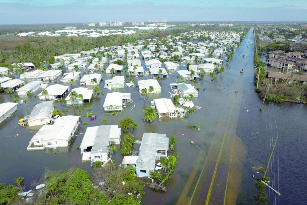
A day earlier, Ian hammered Cuba, leaving the entire Caribbean island nation without power. It was expected to crash ashore into Florida on Wednesday afternoon at about 2 pm in Charlotte County, about 100 miles south of Tampa and just north of Fort Myers.
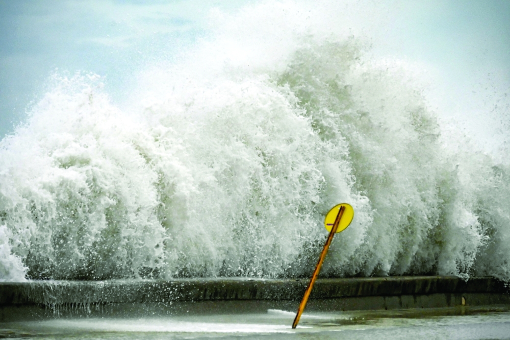
The Miami-based National Hurricane Center warned that Ian would unleash wind-driven high surf, torrential rains that may cause coastal flooding of up to 12 feet along with intense thunderstorms and possible tornadoes. The storm's outer bands were already bringing heavy winds and rains to much of the Gulf Coast on Wednesday morning.
The Florida coastal zone at highest risk is home to miles of sandy beaches, scores of resort hotels and numerous mobile home parks, a favourite with retirees and vacationers alike.
Some 78,000 homes and businesses in Florida were without power early on Wednesday, and tens of thousands more could go dark before the storm passes.
Deanne Criswell, administrator of the US Federal Emergency Management Agency, said one of the top concerns was the safety of Florida's large elderly population. Many have health and mobility issues or are in hospitals, nursing homes and other facilities that are difficult to evacuate.
"We have a lot of individuals who are ... medically dependent on electricity. We know there's going to be power outages. That's going to be one of our big concerns," she told MSNBC.
Overnight and into Wednesday morning, Hurricane Ian pounded the Florida Keys island chain to the southernmost shores of the state's Gulf Coast with heavy rains showers and winds gusts of 40 mph, the National Weather Service reported. -- Reuters
Oman Observer is now on the WhatsApp channel. Click here