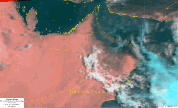


Muscat: Oman Meteorology said that the latest satellite images show the concentration of a low-pressure area near the coast of India (Gujarat), with chances of it developing in the coming hours into a tropical depression.
It added that there are opportunities for high and medium clouds to flow over the Sultanate of Oman, with chances of rain over the Hajar Mountains on Saturday afternoon and evening.
"There is a continuous flow of high and medium clouds associated with the tropical depression on the coasts of the Sea of Oman and on parts of the governorates of North and South, Al Sharqiyah, Al Wusta, and Al Dakhiliyah. which will lead to the formation of local clouds over parts of the western and central Al-Hajar Mountains."
On Friday, the Civil Aviation Authority (CAA) issued the first report on the weather situation in the Arabian Sea.
The text of the report was as follows:
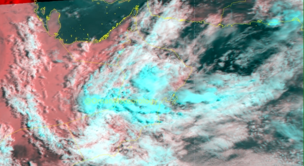
The latest satellite images and analyzes of the National Center for Early Warning show the multiple risks to the formation of a low air pressure area in the northeast of the Arabian Sea which is currently stationed near the Indian coasts (Gujarat), and the wind speed around the center is estimated at less than 17 knots, and forecasts indicate the possibility of its development during this period. Tonight and tomorrow morning to a tropical depression as it moves westward towards the coasts of the Sea of Oman during the next two days, as the effects are likely to begin gradually from Sunday morning.
July 17, 2022 AD and will continue for several days to come.
Here are the details of the report by day:
Saturday, July 16
Spread of medium and high clouds over most of the regions of the Sultanate of Oman, with chances of scattered rain over the Al Hajar Mountains and adjacent areas. The sea is calm with waves on the shores of the Sea of Oman and reaches a maximum height of a meter and a quarter of a meter, and rough waves on the shores of the Arabian Sea reach a maximum height of four meters.
Sunday, July 17
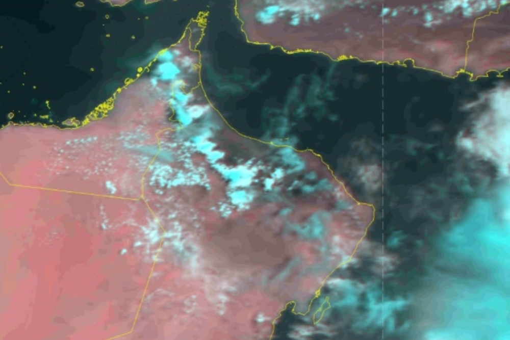
The beginning of the impact of the depression on the atmosphere of the Sultanate of Oman with the entry of convective rain clouds on the governorates of South Al Sharqiyah and North Al Sharqiyah; south of Muscat governorate and in parts of Al Wusta governorate; with rainfall of varying intensity.
Monday, July 18
The impact of the tropical depression extends to the governorates of Muscat, North Al Sharqiyah, South Al Sharqiyah, Al Wusta, Al Dakhiliyah, South Al Batinah, and North Al Batinah, Al Buraimi, Al Dhahirah and Musandam with rainfall of varying intensity. The Civil Aviation Authority urged everyone to take precautions and not to risk crossing wadis and exercise caution while going to sea during this period. Expected effect
Rainfall of varying intensity, causing wadis to overflow
Wind gusts ranging from 15 to 70 knots (71 km/h / 01 km/h).
Reduced horizontal visibility during thunderstorms.
The sea will be rough with waves on the coasts of the Sea of Oman and the Arabian Sea, with a maximum height of four meters.
Chances of seawater spilling over some low-lying coastal parts.
Oman Observer is now on the WhatsApp channel. Click here