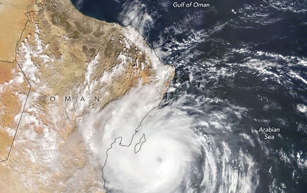
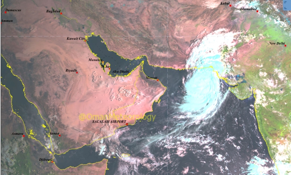


Muscat: Oman’s weather office on Friday issued a tropical storm alert and warned it is likely to intensify into a category-1 cyclone and move towards the Muscat coast. The cyclone is expected to make landfall on Sunday, October 3rd.
“Latest weather charts analysis at the National Multi Hazards Early Warning Center indicates that the tropical storm (Shaheen) is located over the northeast of Arabian Sea at longitude 64.4°E and latitude 23.3°N. The tropical storm continues to move towards the coastal areas of Oman Sea with estimated surface wind speed around the center between 34 to 63 knots (62 to 116 km/hr),” Met Office said.
The center of the storm is about 650 km away from the Muscat Governorate and the closest convective clouds band associated with the storm is about 500 km.
The storm is likely to further intensify into a tropical cyclone (category 1) during the next 24 hrs and continues to move towards the coastal areas from Muscat to north Al Batinah governorates and the storm is expected to make landfall on Sunday 3rd October 2021 evening time.
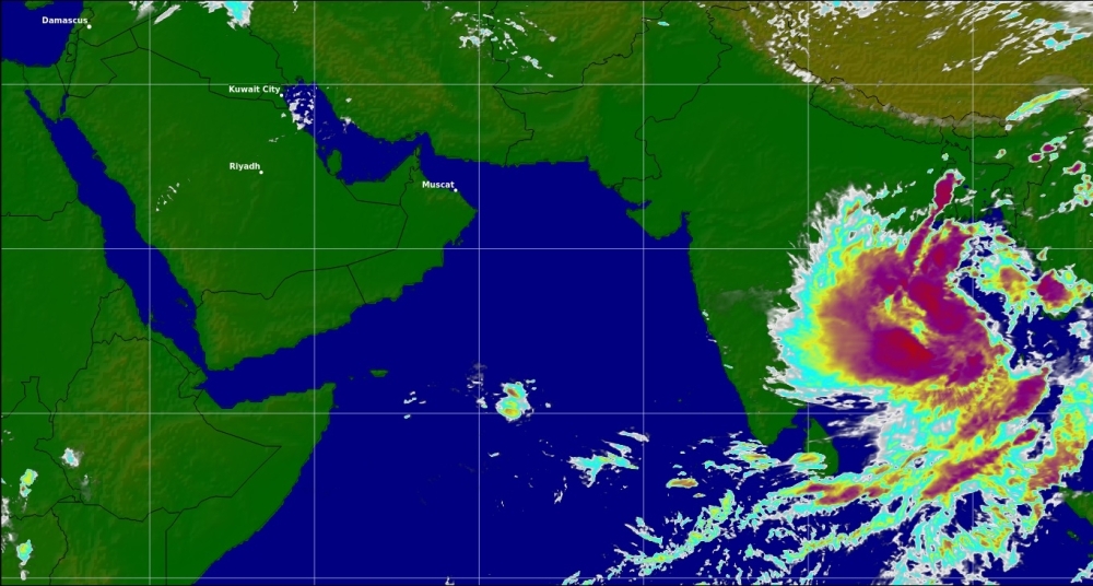
The storm is expected to directly impact the coastal areas from Muscat to north Al Batinah governorates starting from Sunday including strong winds and heavy rain ranging between 150 and 600 millimeters causing severe flash floods.
Rough seas are expected over the coastal areas between South Al-Sharqiya to Musandam Governorates starting gradually from tomorrow evening with maximum wave height ranging between 8 and 12 meters.
In addition storm surge might cause seawater inundation over low-level coastal areas. The sea state will be rough along the rest of Omani coasts with a maximum wave height between 3.0 and 5 meters.
The Civil Aviation Authority advises the public to take proper precautions, stay away from the low-lying areas and avoid crossing wadis.
The Authority also advises the fishermen and sea goers to avoid venture into the sea and follow latest and updated bulletins from the National Multi-Hazard Early Warning Centre.
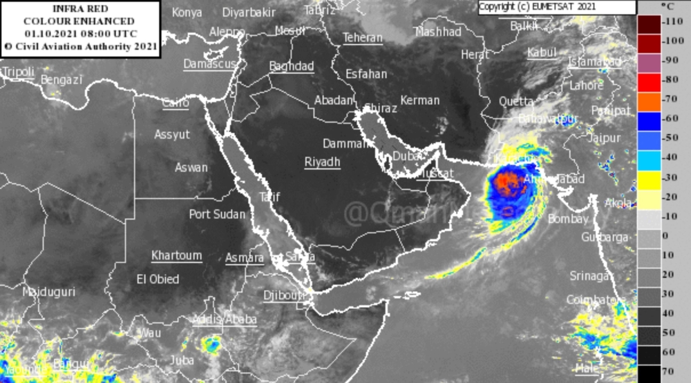
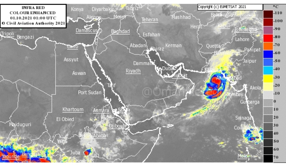
PREDICTED PATH OF THE CYCLONE

Oman Observer is now on the WhatsApp channel. Click here